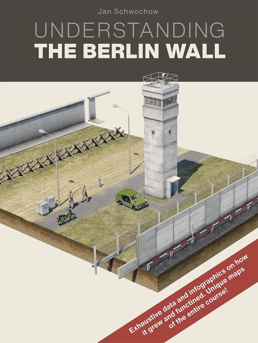
Berlin Wall infographics compendium now in English:- Modern maps of its entire historic course- Detailed illustrations on how it functioned- Hard-to-find facts and charts Understanding The Berlin Wall is a unique, pocket-sized guidebook that is indispensable for gaining insight into the mechanics of the Cold War´s most iconic structure. It contains some of the most detailed maps of the Wall´s 160 km route now available to the general public. The plan makes it possible to visit any point along the barrier´s former course, and compare what it looks like today to the period when it completely enveloped West Berlin, dividing communities and separating friends and families. Another section outlines a tour of the entire course, to over 50 sites where Wall ruins and other historic fortifications remain visible. Understanding the Berlin Wall abounds with sumptuous 3-D infographics, timelines and illustrated charts that explain at a glance the various phases of Wall´s construction, the procedure at each of the city´s border crossings, plus hard-to-find statistics about escape victims, tunnel routes and much more. Understanding the Berlin Wall was written and designed by Jan Schwochow, one of Germany´s most celebrated visual journalists and author of many infographics books, including The World Explained, from Prestel. Like Understanding The Berlin Wall, the books portray complex information in an easy-to-understand way.